


Trail Town USA
Damascus, Va.
Damascus is a small town in Southwest Virginia with a big claim to fame: Seven nationally known trails intersect within town limits, making it “Trail Town USA”. Originally a railroad town in the lumber boom of the early 20th century, this small-town economy reinvented itself through outdoor recreation and tourism in the 1990s and has been thriving ever since. Tourism is one of the largest economic drivers in Washington County, VA, second only to agriculture.
As one of just three downtowns that the A.T. passes through, along with Hot Springs, NC and Hanover, NH, Damascus is also known as the Friendliest Town on the Trail.
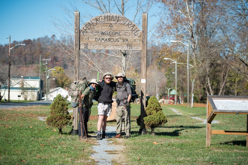
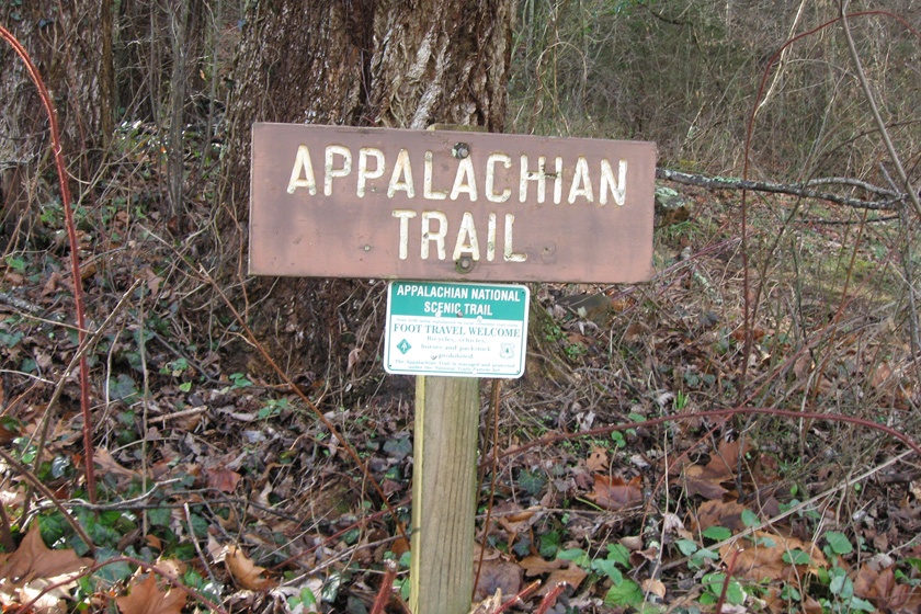
Damascus is the first stop for NOBO thru-hikers once they reach the state of Virginia. Opened in 2022, the ATC’s Damacus Trail Center is a hub for experienced outdoor enthusiasts, nature lovers, casual Trail visitors and volunteers alike to learn more about the wide range of outdoor resources throughout the region. The Appalachian Trail crosses the Tennessee / Virginia state line just a few miles south of town, then runs through the Town Park and down the sidewalk of Main Street. The trail crosses paths with the famous Virginia Creeper Trail at several points. Just north of town is the fan-favorite Mount Rogers High-country and Grayson Highlands State Park.
The biggest event of the year in Damascus is the Appalachian Trail Days Festival, known locally as ‘Trail Days’. Each year in May, the town swells from 650 residents to an estimated 20,000 people for the weekend. Trail Days is a celebration of the Appalachian Trail and thru-hiker culture and a massive reunion of hikers past and present.”
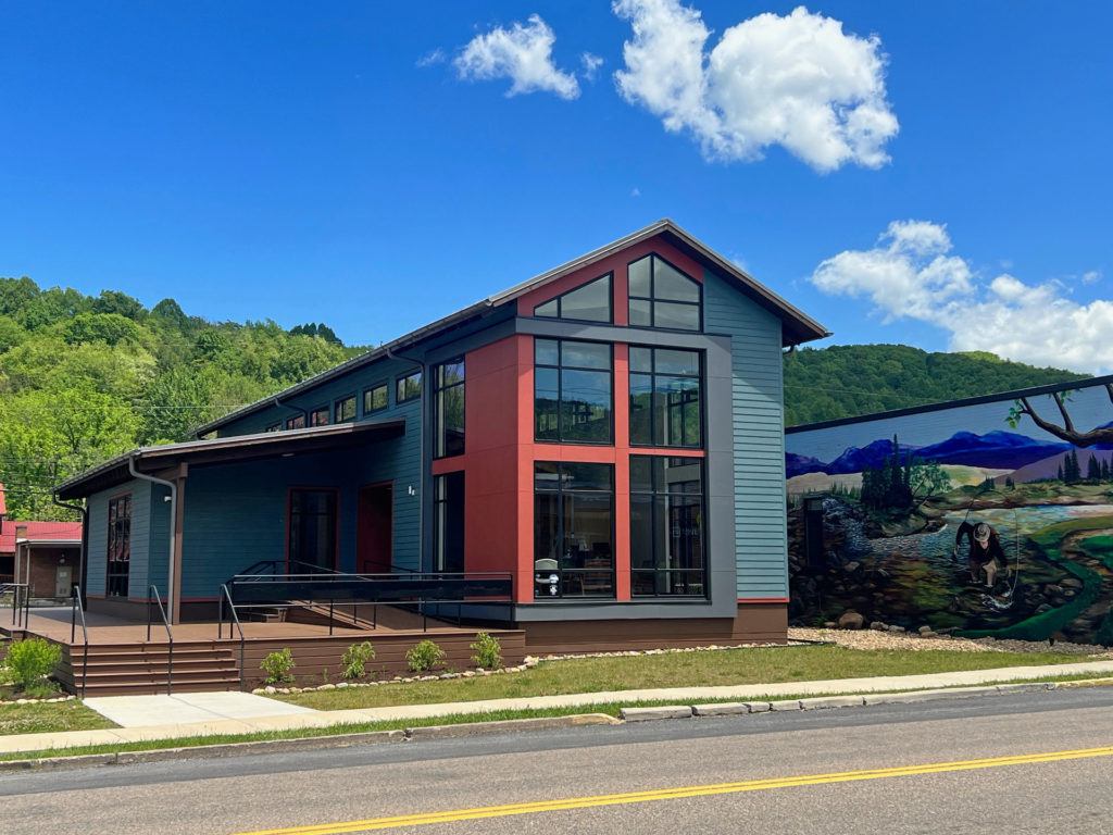
- Damascus Trail Center – A collaboration between the Town of Damascus and the ATC, the Damascus Trail Center embraces and enhances southwest Virginia’s growing status as a hub for outdoor recreation.
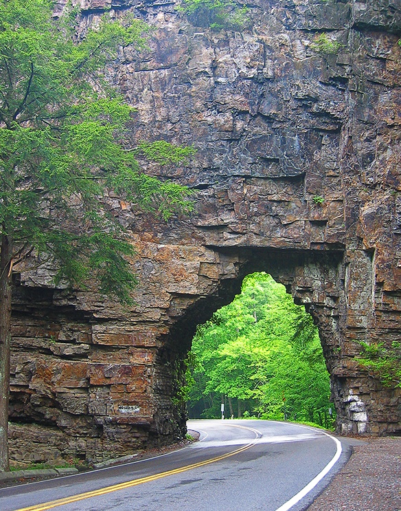
- Enjoy a picnic at Backbone Rock and view waterfalls as well as the shortest tunnel in the world!
- Look for that perfect thing you just gotta have at The Briar Patch Antiques, Etc.
- Bike the beautiful Virginia Creeper Trail.
- Observe wild ponies at Visit Grayson Highlands State Park.
- Explore even more things to do at VisitDamascus.org
• Damascus Branch Public Library
• Damascus Outfitters
• Eula’s Hair Styling
• Junkin’ Shenanigans
• Mt. Rogers Outfitters
• Lady Di’s Bed & Breakfast
• The Dancing Bear Inn
• The Seymore House and Big Dam Room
• Town of Damascus
These businesses support the Trail by taking part in the A.T. Community Supporter program.


Featured Local Hikes
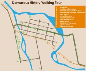
Damascus History Trail:
HIKE 1: Damascus History Trail Walk.
 Welcome to the Damascus History Tour!
Loop. Length roundtrip: 2.4 miles. Elevation: No elevation change. Difficulty: Easy. Parking: at caboose, Damascus Town Park (N 36.63531, W 081.79198).
This is the suggested path for walking or riding the Tour, with informational signs arranged in order, and distances indicated. There is some backtracking involved.
The route is suitable for walking or biking, and some of it is wheelchair accessible.
![]()
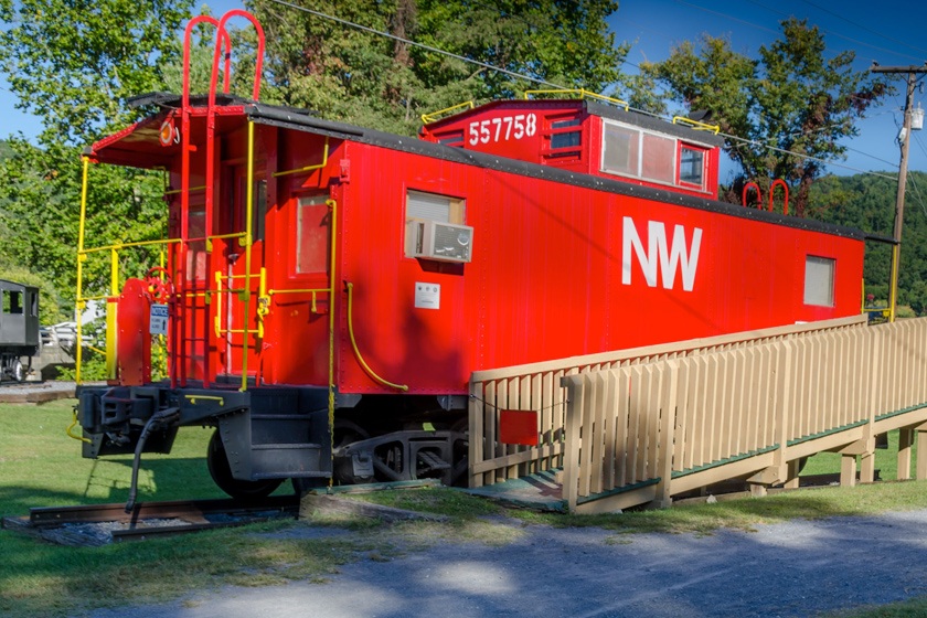
1 – Water Tanks
Begin at the red caboose in the Damascus Town Park. Near the caboose is a small black engine. This was used on narrow gauge railroads that hauled timber out of the mountains in this area.
Cross the main road and walk north on the Virginia Creeper Trail (formerly a railroad) for about 1/10 mile. Next to the creek and an informational sign, you will see the remains of concrete pylons, the foundation for the old water tank where the original steam engine would stop to refill.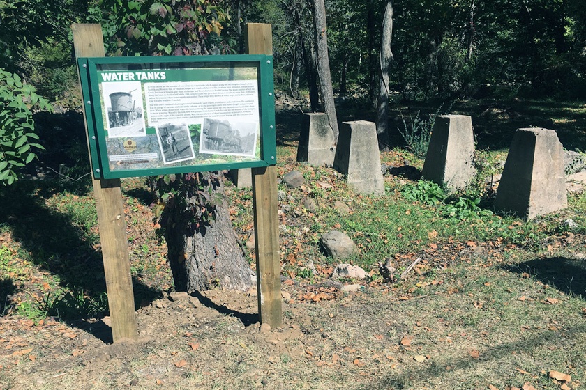
2 – Founders of Damascus
Walk back toward the red caboose and you will find the sign featuring the earliest settlers of Damascus. (1035 feet from Sign 1.)
3 – Electricity Comes to Damascus
From the Founders sign, walk about halfway across the old railroad trestle (270 feet from sign 2) over Beaverdam Creek, learn about the first electric plant in Damascus and look down to view the old concrete water channel that supplied water to power it.
4 – The Train Depot and Hassinger Lumber
From the trestle, walk back out to the red caboose and turn left onto the Appalachian Trail, southbound. Walk a couple of hundred yards to the playground and find the sign which sits on the location of the old railroad station. (952 feet from Sign 3.) Here you will learn about the lumber industry and the family which started this industry in Damascus.
Continue southbound along the Appalachian Trail and through the Welcome arch for hikers (an Eagle Scout project). You will also notice an old AT Shelter near the Arch.
5 – Rock School
Turn left at the library and cross the Water St. Bridge (to be reconstructed in 2022) and find the informational sign for the Rock School. (1139 feet from Sign 4.) Building this school was a huge effort using many volunteers back in the early days of the town.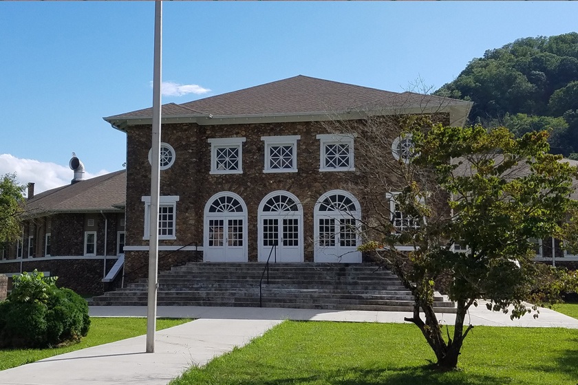
6 – Beaverdam Chemical Works
Backtrack across the bridge to the library and turn left and cross the new pedestrian bridge over Beaverdam Creek.
In a short distance you will see a sign on the right next to a fence and facing an empty field. (1250 feet from sign 5.) This was the site of one of the largest industries in Damascus, a dye plant, from 1918 to 1985.
7 – Virginia Creeper Trail
From Sign 6, to avoid walking on the road without a sidewalk, walk between the ball fields and along Beaverdam Creek until you get to the parking lot at the Rock School. Go out to Shady Avenue at that point and turn left. At the Rock School, cross the road to the sidewalk. Then, when you reach the Creeper Trail crossing at the drugstore, turn right and go a hundred feet or so. Here you will find an informational sign on the Virginia Creeper National Rail Trail, the economic engine that powers Damascus by bringing in people who enjoy bike riding. (Distance is approximately 2500 feet from Sign 6 to Sign 7.)
8 – Trails of Damascus
From the Creeper Trail sign, continue east along the Creeper, passing the Town Pool, and walk across Trestle 17 over Laurel Creek. Here you will find an informational sign which is a listing of all the long trails coming through Damascus. Some are new and some have a long and rich history. (1302 feet from Sign 7.)
9 – Legion Island
After reading about the trails in Damascus turn around and walk down South Railroad Avenue (the road behind you) for two blocks. Cross Laurel Avenue and turn left and cross the road bridge where you will find the sign overlooking Legion Island, once the center of summer recreation in Damascus. (1533 feet from Sign 8.)
10 – Churches of Damascus
From Legion Island walk toward the center of town and cross Laurel Avenue to the Presbyterian Church. Here you will learn about the first churches in Damascus. (1096 feet from Sign 9.)
You will see special bricks on Laurel Ave. Some have names of Damascus residents; others celebrate the hikes of many Appalachian Trail hikers.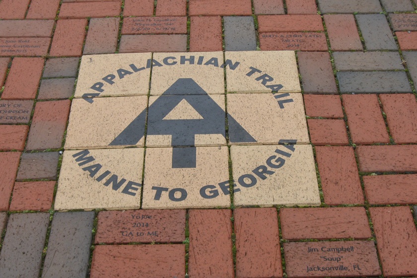
11 – Laurel Avenue
 Cross Laurel Avenue again and continue your walk past the new Trail Center (completed in 2021). At the bridge over Beaverdam Creek, you will find Sign #11 at the ruins of an early 1900s water powered electric plant. The photos on the sign provide an idea of what the main street of Damascus looked like in earlier times. (675 feet from Sign 10.
12 – Damascus Old Mill
Turn onto North Smith Street, then right on West Liberty Avenue. Go to Reynolds Street and turn left near the Post Office. This will take you down to the mill pond and the Damascus Old Mill. This historical structure, originally a grist mill, has gone through many transitions and remains a tourist attraction, inn and restaurant. (688 feet from Sign 11.)
This concludes the Damascus History Tour. To return to the caboose where you started, turn around, leaving the Old Mill and walking down North Reynolds St. past the Post Office, then cross Laurel Ave., continuing on South Reynolds to the Creeper Trail, bearing right and crossing Trestle 16 to reach the caboose in the Town Park.
HIKE 2: Appalachian Trail South to the TN-VA line:
Hike on Appalachian Trail toward TN-VA state line.
In and out hike. Length roundtrip up to 6.5 miles. Optional turnaround midway. Elevation gain to state line: 1,294 ft. Difficulty: Moderate; some uphill.
Note: Although by GPS, the hike on the A.T. from Damascus to the TN/VA state line is 2.25 miles, since the trail is not straight, the actual distance is about a mile farther.
A.T. South, Mile 0.0: From the Appalachian Trail Arch in the Damascus Town Park across from the Library, turn and follow the white blazes one block, then enter the woods at the Appalachian Trail sign between two houses. Follow the white-blazed A.T. as it curves around several small switchbacks, some with log steps or rock steps. Switchbacks minimize trail steepness and help prevent erosion. Volunteers from the Tennessee Eastman Hiking and Canoeing Club (TEHCC), assisted by students from Appalachian State University, installed these steps in 2008. The entire Appalachian Trail, 2,190 miles from Maine to Georgia, is maintained by 31 all-volunteer trail clubs.
Here, the section of the A.T. past the switchbacks runs mostly on an old woods road which was used by local residents and also for hauling out timber. As on many sections of the A.T., there is a great deal of rhododendron, which blooms in May. American holly can be seen on the edges of the trail within the switchbacks.
Mile 1.8. Elev. 2,739 ft. Here is a campsite, fire ring, and a blue-blazed trail leading to a spring. Volunteer trail maintainers mark springs so hikers can replenish their water supply. Hikers carry water filters to remove harmful bacteria from water they use on the trail.
Those who wish may turn around at this point and retrace their steps back to the arch in the Damascus Town Park.
For those who wish to continue to the state line: About midway between the campsite and the state line, notice logs crossing the trail diagonally. These are waterbars, installed by trail volunteers to help divert water off the trail and prevent erosion. Another way to do this is to dig drainage dips.
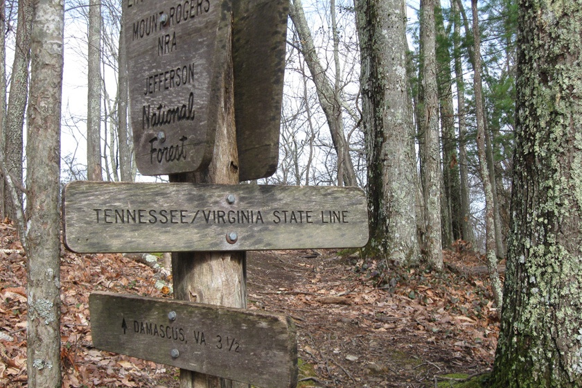
Mile 3.25. VA-TN state line. (N 36.61430, W 081.82558) Elevation: 3,221 ft. Besides the boundary between two states, the Virginia/Tennessee state line on the A.T. marks the boundary between two national forests: the Cherokee and the Jefferson. For Appalachian Trail thru-hikers (those who complete a hike on the A.T. in a single season), this is the point for northbound hikers to start the long trek through Virginia. (A quarter of the Appalachian Trail, 550 miles, lies in VA.)
Note: Anyone who would like to cover this part of the trail with cars at both ends can leave a car for the end of their hike at Backbone Rock, about 4 road miles from Damascus. Then from the state line, they can continue into TN on the A.T.: just over a mile to the Backbone Rock Trail (blue blazed), then 2.5 miles farther to the Backbone Rock pkg. lot. See “A Visitor’s Guide to Short Day Hikes Near Damascus” for further information.
Get Involved
 Mount Rogers Appalachian Trail Club
The Mount Rogers Appalachian Trail Club maintains 59.4 miles of the Appalachian Trail from the TN/VA line north to the South Fork of the Holston bridge, Rte. 670, in Teas, VA. The club welcomes guests on Trail work trips and recreational hikes. Visit www.mratc.org for schedule and more information.
ATC Volunteer Program
The Appalachian Trail Conservancy is always looking for dedicated volunteers to help maintain the A.T. and assist in our visitor center and headquarters. Opportunities range from greeting visitors and providing information about local hikes to joining a Trail crew for week-long maintenance trips, gaining first-hand experience in what it takes to keep the A.T. open and enjoyable for millions each year. Learn more at appalachiantrail.org/volunteer.