


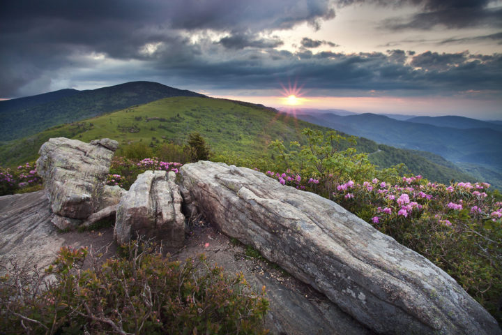
The sunrise side of the Blue Ridge.
Nelson County, Va.
Nelson County offers visitors the opportunity to experience the wilderness and rich rural traditions of those who love to call it home. The county’s mountainous terrain includes 45 miles of the Appalachian Trail replete with vistas of the Blue Ridge Mountains and the deep green splendor of the George Washington National Forest. Within this bounty of natural beauty are miles of hiking trails, crystal-clear fishing streams, historic family farms and orchards, picturesque vineyards, inviting tap rooms and unparalleled views.
Learn more about Nelson County at www.nelsoncounty-va.gov
- Sip and savor your way along Nelson County’s craft beverage trails. If you’ve worked up a thirst on your hike, there’s no shortage of breweries, cideries, distilleries and wineries. For the beer lover, visit the Brew Ridge Trail, Virginia’s original beer trail ; the trail links 6 award winning breweries. For beer, wine, distilled spirits and cider lovers, Nelson 151 boasts 13 producers in a 15 mile stretch of gorgeous views and easy travel. Nelson’s newest craft beverage trail, Nelson 29 showcases wine, beer and America’s first single malt whisky. ATC corporate partner, Devils Backbone Brewing Company is a favorite of AT hikes, offering rides to and from the trail at Reid’s Gap, on site camping and a famous breakfast. The first brewery in Nelson County, Blue Mountain Brewery, is also an AT Community supporter.
- Whatever floats your boat, Nelson County‘s got it! From Lake Nelson to the County‘s three rivers, you can tube, canoe or kayak anything from flatwater to class IV rapids. Click here for access points and recommended sections to paddle on the James River, Tye River, and Rockfish River.
- Load up on a bushel of fresh flavor at the orchards and farms along the Blue Ridge Fruit Loop. From May through October, select from a wide variety of apples, Asian pears, blackberries, blueberries, cherries, nectarines, peaches, plums, strawberries, sweet cider, fruit jams, jellies, and more! From pre-picked (fruit) or pick-your-own (fruit or berries), find your favorites while enjoying spectacular views of the Blue Ridge Mountains. Want to go beyond fruit? Nelson County‘s picturesque farms also produce produce fresh vegetables, local organic meats, honey, cider, mushrooms, flowers, lavender & herbs, goats & sheep, alpacas, edible plants, hops, vinegars, baked goods, Christmas trees and more! Find out what’s in season at the Nelson Farmers Market on Saturday mornings May through October, or the Indoor Community Market at Rockfish Community Center out of season.
- Find indoor and outdoor fun for the whole family at Wintergreen Resort’s Discovery Ridge Adventure Center. With Virginia’s largest tubing park, ziplines, miniature golf, a bungee trampoline, climbing tower and campfire facility, there’s something exciting for everyone to try.
- Wind down or rock out to some great live music! Nelson County‘s broad range of venues hosts local musicians of all stripes. Catch an intimate show at at Rapunzel’s Coffee or immerse yourself in in a multi-day festival experience. Music fans flock to Nelson County for Lock’n, Hoopla, and The Festy each year. The Humpback Rocks Visitor Center hosts Mountain Music performances all summer, in a beautiful setting along the Blue Ridge Parkway, and classical music fans won’t want to miss the Wintergreen Music Festival.
- Get away from it all in Montebello, the perfect setting for a relaxing mountain retreat. An abundance of campgrounds and rental cabins offer lodging options from rustic to luxurious. Take a hike on the Crabtree Falls Trail, the Montebello Nature Trail, or the A.T., sign up for a guided horseback ride with Appalachian Horse Adventures, or go fishing at the Montebello Camping and Fishing Resort. Be sure to visit the Montebello Country Store and Cafe for a bite to eat and anything your mountain adventure might require!
These businesses support the Trail by taking part in the A.T. Community Supporter program.


Featured Local Hikes
Hike 1: Jack Albright Loop
Route Type: Loop
Hike Difficulty Rating: Moderate to Strenuous
Hike Length: 3.7 miles
Description:
This hike starts from the same parking lot as the popular Humpback Rocks hike, but is less well-known. Even when the parking lot is bustling, this route is typically not crowded. Making a loop with the Appalachian Trail and the Jack Albright Trail, the route features one scenic overlook, and the option to extend the hike with a visit to an A.T. shelter. This is a great area to look for wildflowers in the spring, and interesting moss/lichen communities on the rocks year-round. There is a map of the loop hike on the kiosk at the southeast corner of the parking area.
If facing the information kiosk in the Humpback Gap parking area, with the wide and heavily-used Humpback Rocks Trail directly ahead of you, the Jack Albright Trail is behind you at the northeast corner of the parking area. The trail starts with a set of steps then continues for about one quarter of a mile to where the trail turns sharply left. Follow the Jack Albright Trail for 1.7 miles, until its signed junction with the white-blazed Appalachian Trail. The first .7 miles is a gradual uphill climb, passing near the summit of Dobie Mountain before descending on a series of switchbacks to an old logging road which will join the A.T. in about one half mile.
At the A.T. junction, turn right/south to complete the loop. (For a longer and more strenuous hike, turn left/north and follow the A.T. 1.5 miles to Paul C Wolfe Shelter. This additional out-and-back adds 3 miles, making the hike a total distance of 6.7 miles.)
Following the A.T. south from its junction with the Jack Albright Trail, in 0.4 miles look on the east side of the A.T. for a signed side trail to Glass Hollow Overlook. Take the short side trail to enjoy views of Rockfish Valley, then return to the A.T.
Continue to follow the white-blazed A.T. South for another 0.9 miles to reach its junction with the other end of the Jack Albright loop trail, with a sign for the parking area. Turn right onto this short connector trail, which returns to the parking area in 0.2 miles.
The Jack Albright Trail can be hiked in either direction – this version saves the views from Glass Hollow Overlook for the end of the hike.
Driving Directions: This hike starts from the Humpback Gap Parking area, at milepost 6.0 on the Blue Ridge Parkway – not to be confused with the nearby Humpback Rocks Visitor Center at milepost 5.9 or the Humpback Rocks Picnic Area at milepost 8.5. From Interstate 64, between Waynesboro and Charlottesville, take exit 99 for Afton/US 250. Follow signs for Blue Ridge Parkway. Follow the Blue Ridge Parkway south for 6 miles. Just after passing the Humpback Rocks Visitor Center on the right, look for the Humpback Gap parking area on the left. Coordinates: 37.968463, -78.896831
Hike 2: Virginia Blue Ridge Railway Trail
Route Type: Out & Back
Hike Difficulty Rating: Easy
Hike Length: 3.4 miles
Description:
The Virginia Blue Ridge Railway Trail follows the banks of the scenic Piney River along an old railroad bed for 7 miles, and is open year-round to hiking, biking, and horseback riding. The main trailhead, featuring a refurbished caboose and nature info for kids, is located right along Highway 151 so it’s easy to access for a quick leg-stretcher or a longer hike when exploring the Brew Ridge Trail, the Blue Ridge Fruit Loop, and other scenic driving routes in Nelson County. The route described here uses another trailhead as a convenient turnaround spot.
From the trailhead on Highway 151, follow the wide, crushed stone Virginia Blue Ridge Railway Trail. Keep an eye out for abundant wildlife, and wildflowers in spring and summer. This trail occupies the rail bed of the former Virginia Blue Ridge Railway, which ran from Tye River Depot (to interchange with the Southern Railway) to Massies Mill. Construction of the railroad started in 1915 and the line was abandoned in 1980.
In 1.7 miles, reach the trailhead parking lot in Roses Mill, with restrooms available. Return the way you came, or continue on if you’d like a longer hike.
Driving Directions: The trailhead is located at 3124 Patrick Henry Highway, Piney River VA and features ample parking and restrooms.
Get Involved
 Old Dominion Appalachian Trail Club
The Old Dominion Appalachian Trail Club maintains about 20 miles of the A.T. in Nelson County, and hosts a trail work weekend once a month. For more information, visit http://olddominiontrailclub.onefireplace.org/
The Tidewater Appalachian Trail Club
The Tidewater Appalachian Trail Club’s 11-mile A.T. section is primarily in the beautiful Three Ridges Wilderness. TATC holds three big trail work weekends a year, with occasional smaller trips as well. Find details at https://www.tidewateratc.com/
Natural Bridge Appalachian Trail Club
The northern end of Natural Bridge Appalachian Trail Club’s 90-mile A.T. section is in Nelson County. NBATC is a volunteer based hiking club that provides opportunities for recreational hiking on the Appalachian Trail (A.T.) and other trails in central Virginia. NBATC volunteers maintain over 90 miles of the A.T. as well as other hiking trails in central Virginia for the benefit of current and future hikers. Learn more and become a member at https://www.nbatc.org/
ATC Volunteer Program
The Appalachian Trail Conservancy is always looking for dedicated volunteers to help maintain the A.T. and assist in our visitor center and headquarters. Opportunities range from greeting visitors and providing information about local hikes to joining a Trail crew for week-long maintenance trips, gaining first-hand experience in what it takes to keep the A.T. open and enjoyable for millions each year. Learn more at appalachiantrail.org/volunteer.
Discover More
Roan Highlands Haven
Appalachian Balds are for the Birds
The iconic bald mountains along the Appalachian Trail in North Carolina and Tennessee are significant to the future of migratory and resident birds.
By Jennifer Pharr Davis
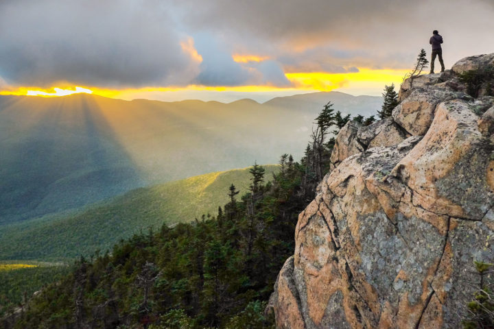
Scenic Views
Wide-open vistas beyond the footpath offer respite and are essential to the Wild East.

By Marina Ritchie
Wild Skyway
Wherever you are on the Appalachian Trail, birds offer sweet companionship. Yet, as hiker numbers soar, bird populations tumble.